PhD research at UWH
Application of
Remote Sensing technologies for the Environmental impact analysis
in Kumtor
gold mining company
Abstract
Nowadays the Environment Protection is very important. But actually, this action remains unfulfilled. This research will introduce the assessment and research of impact of the Kumtor gold mining on the environment through remote sensing technologies (high resolution GeoEye-1 and WorldView-3 satellite images with possibility stereoscopic, multispectral, and near-infrared archive data). After completion of this research will get the results for following: a growth monitoring waste - dumps, horizontal-vertical displacements, determining the area of waste - dumps, measuring the volume of waste - dumps and one of the main environmental problems associated with storage huge amount of waste-dumps on the glacier and the disappearance of glaciers.
Common uses of Elevation Models include:
- Creation an Ortho from existing RPC model
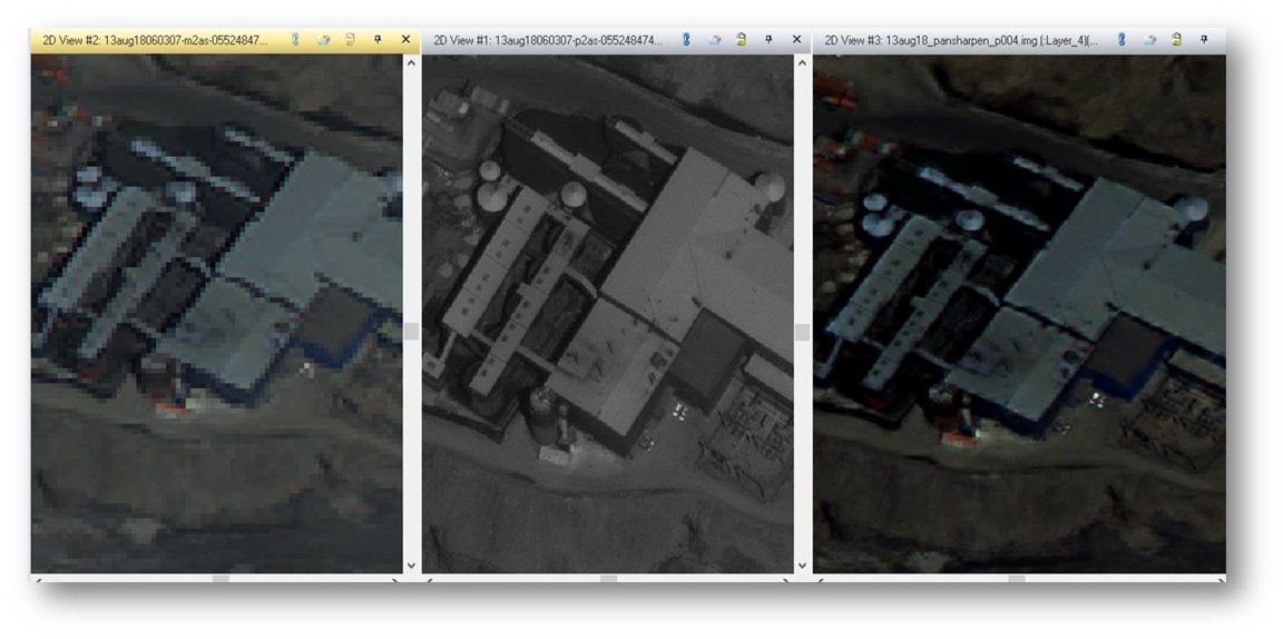
- Hyperspherical Color Space (HCS) Pan Sharpening
- Supervised Classification
- Discriminant Function Change Detection
- Rendering of 3D visualizations as DTM (DEM) extraction and modeling mass movement
These satellite images courtesy of the DigitalGlobe Foundation for this research work.
![]()
WorldView-2 and QuickBird satellite high-resolution panchromatic and multispectral archive image data with possibility stereoscopic.
Data from «QuickBird» satellite (1)

Data from «WorldView-2» satellite (2,3)
| ID image | Date | The angle of nadir | Cloud cover, % | Spatial resolution, m | Spectral band |
| (1)- 10100100024C3900 | 19.09.2003 | 12.27° | 0 | 0.61-2,40 | 4 |
| (2)- 10300100244B7100 | 18.08.2013 | 8.71° | 2 | 0.46-1,84 | 8 |
| (3)- 10300100466BEA00 | 15.08.2015 | 3.78° | 0 | 0.46-1,84 | 8 |

2. Creation an ortho from existing RPC model
 3. Hyperspherical color space (HSC) Pan sharpening
algorithm
3. Hyperspherical color space (HSC) Pan sharpening
algorithm
4. Supervised classification

5. Discriminant Function Change Detection

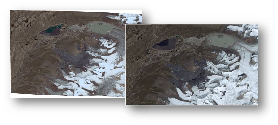
Below
shown how to changed area of glaciers and Kumtor mining.
The blue lines are contours of glacier, red lines are territory of
dumps in Kumtor
gold mining

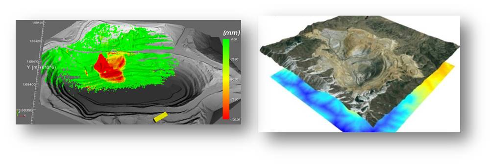
6. DIGITAL ELEVATION MODEL (DEM), DTM extraction
Tie point process

- ENVIRONMENTAL
PROTECTION
- Safety
reserves of fresh water
- Reduced
air pollution
- Reduced
water pollution
- Reduced
degradation of soils and vegetation
- Protected
wildlife and the fish resources
- after
that Economical Development
Establishing Spatial Decision Support System for monitoring future condition of mining area