• Remote Sensing
Course- Remote Sensing
1. Introduction
2. Electromagnetic Radiation
3. Central perspective
4. Photographic systems
5. Passive digital sensors
6. Active sensors
7. Pre-processing
8. Image enhancement
9. Image classification
10. Post-processing
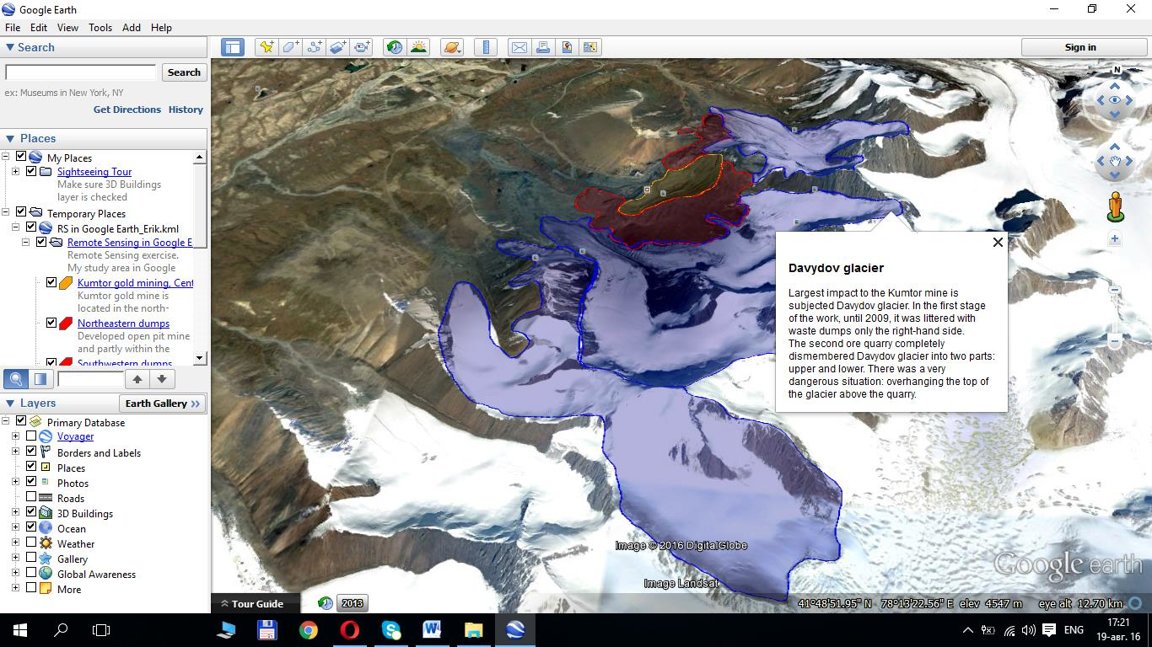
Practical exercise for Remote Sensing in Google Earth
The main aims of the exercise are to get familiar with the different remote sensing imageries, and to practice the visual interpretations.
1. Download, install and start Google Earth:
2. Select Your area.
Minimum 5, connected polygons should be created.
3. Description of Your area (few sentences, paragraphs).
4. Description of the imagery about the selected area. Type of the sensor, resolutions (geometric, spectral, radiometric), date of imagery, etc. You may use the ’Ruler’ (for approximate the geometric resolution), the Copyright (e.g. © 2010 Cnes/SpotImage), the Imagery date (e.g. Imagery Date: Jul 15, 2006), and the coverage of different images (Layers\More).
5. Delineation of the polygons. It is important to delineate the areas, and to create the description (or at least one part) based on the imagery. Do visual interpretation! All the polygons should be connected and consequent!
There are a lot of possibilities to create several hierarchic levels, such as natural forests, plantations, etc.
Practical exercise for Remote Sensing
- Remote Sensing: definition, definition of photogrammetry, most important properties, groupings, application fields.
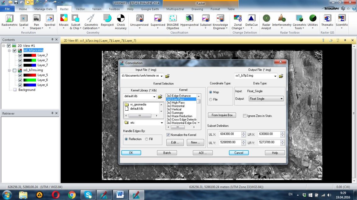
- Image enhancement: histograms and their transformations, filters, band ratios vegetation indexes.

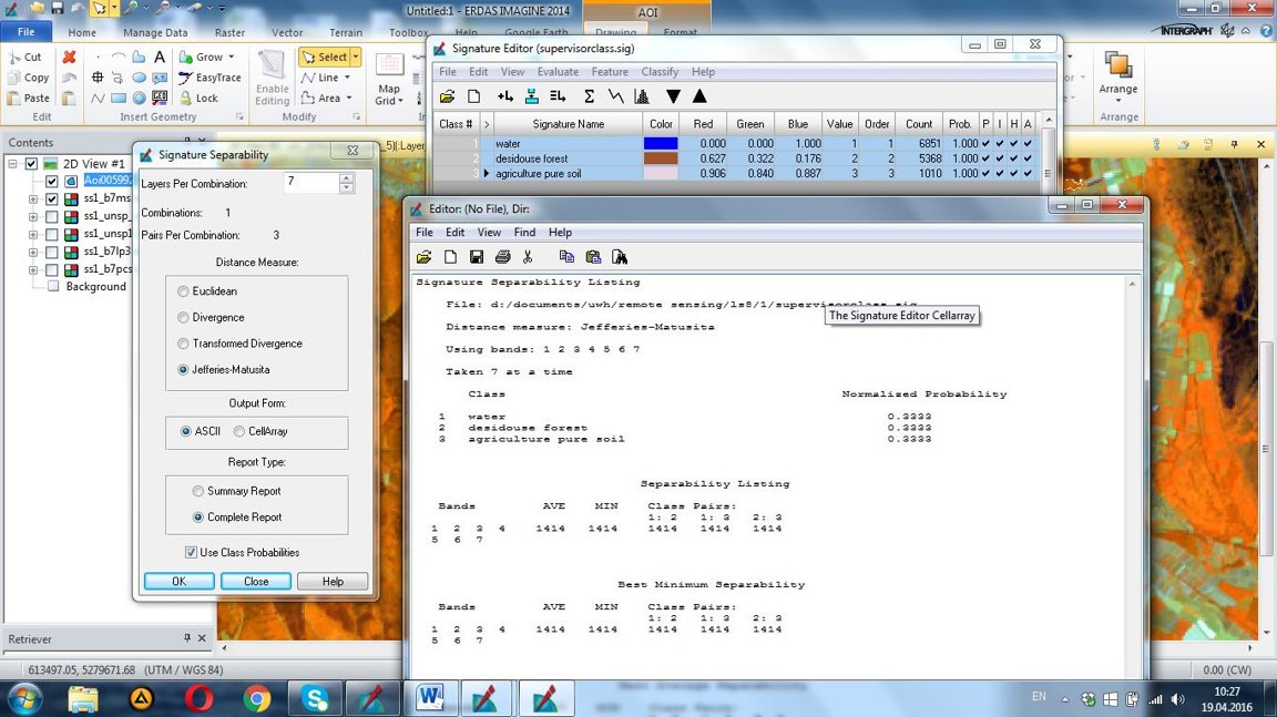
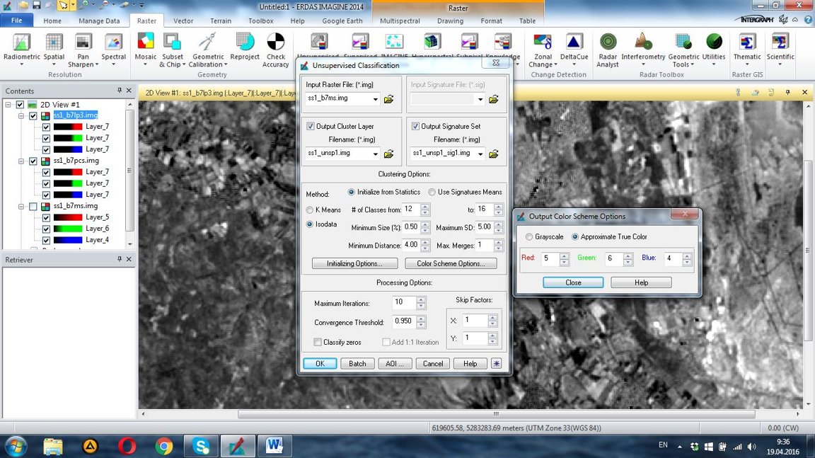
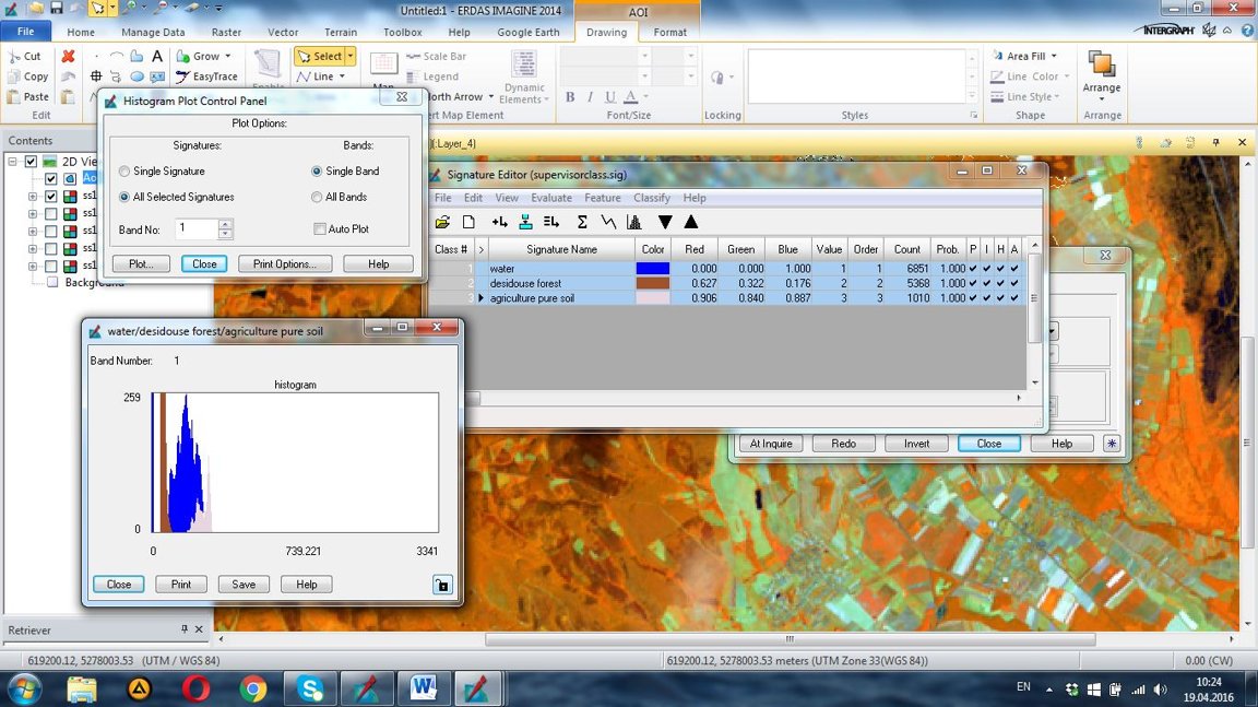
- Image classifications: definition, units of classification, types of classifications, types of supervised classifications and unsupervised classification
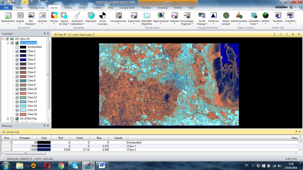
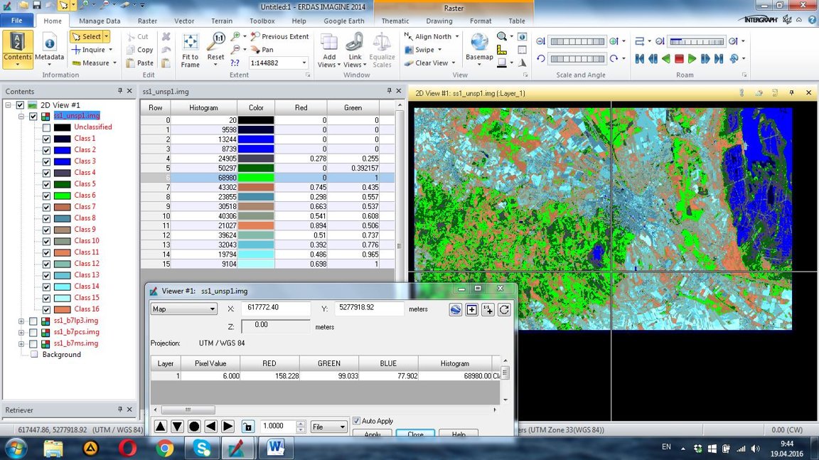
unsupervised classification
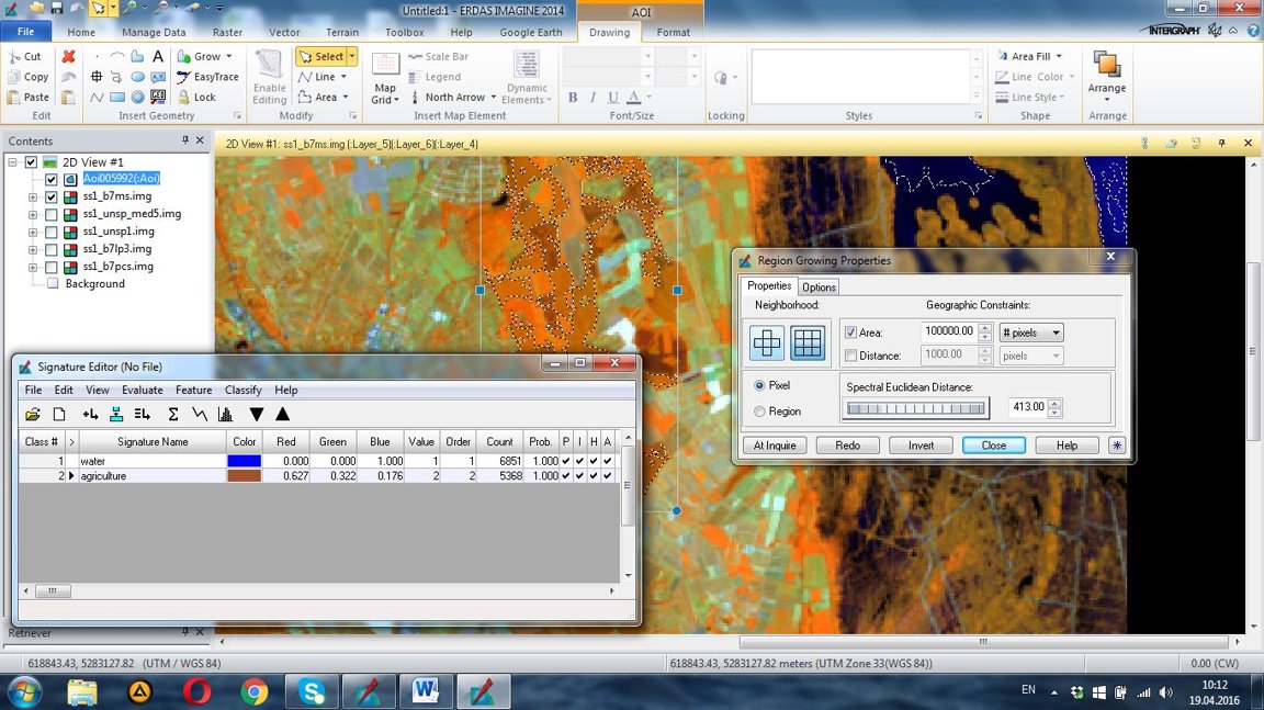
Supervised classification
- Image post-processing: error matrix, error map, GIS-integration, vector-based analysis.